
Southwest Area Conceptual Plan (SWAP)
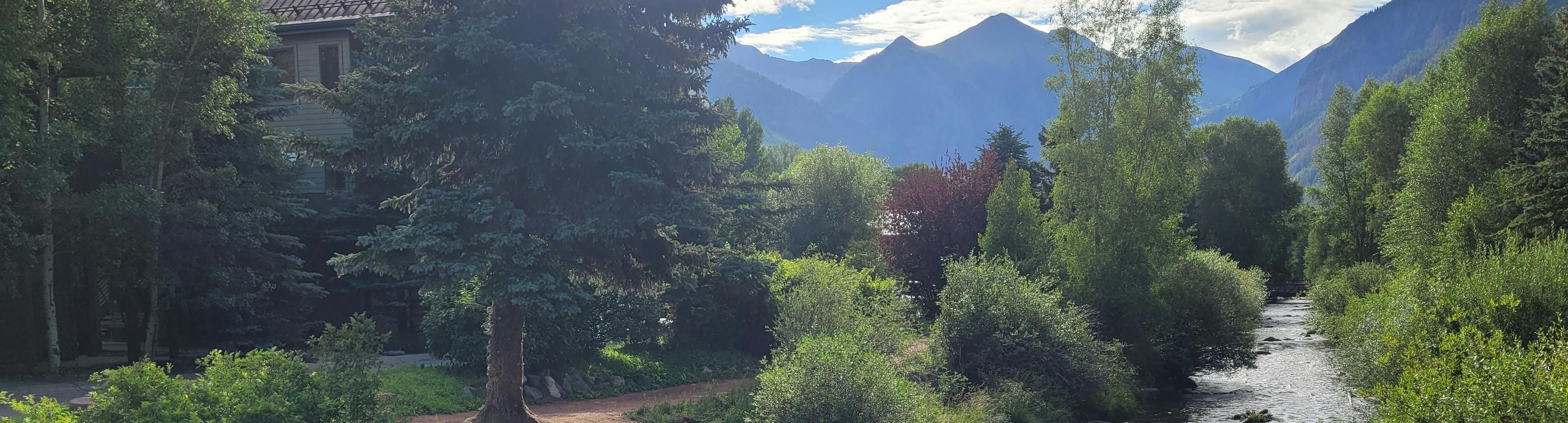
The Southwest Area Conceptual Plan (SWAP) is a long-term vision for improving the southwest part of Telluride. This area includes places like the Shandoka Apartments, Virginia Placer, Longwill, the River Trail, and Carhenge. The plan was created with input from residents and approved by Town Council at its regular meeting on July 13, 2021.
The Telluride Town Council initiated the conceptual planning process in 2019 to determine how best to utilize its publicly owned land in the southwest area of the Town. Over the years, the Town and the Telluride Housing Authority assembled land that included areas south of the Valley Floor along Black Bear Road, as well as areas extending eastward to encompass the Shandoka and Carhenge parking areas. The consultants DHM Design were selected to develop a Conceptual Plan for the publicly owned land and the surrounding streets and pedestrian network.
The conceptual plan was developed collaboratively by the DHM Design Team, Town staff, and the public under the direction of the Town Council. The process and workshop presentations, photos, and notes can be found in the Town's Public Records Portal under Southwest Area Master Plan Subcommittee.
The planning area encompasses publicly owned properties surrounded by private developments, the Telluride Ski Area (Lift 7), and unincorporated county land. Currently, uses within the Town-owned parcels include open space, surface parking, deed-restricted affordable and employee housing, a river park, and road rights-of-way.
Its primary goals are to support affordable housing, improve transportation and safety, and create a more connected, livable neighborhood for the people who call this area home.
Why the Plan Was Created
The southwest part of town is home to many full-time residents and workers. It has important public land, rental housing, and access to open space. But it also has challenges:
- A lot of land is used for surface parking, not homes or parks.
- Traffic and congestion are common, especially near Mahoney Drive and Colorado Avenue.
- There’s a lack of neighborhood businesses and gathering spaces.
- Walking and biking can be unsafe in several spots.
- There’s pressure to grow, but no clear plan for how to do it in a way that helps residents.
The Town launched this planning effort to take a big-picture look at what’s working, what’s not, and what should happen next.
What the Plan Covers
The Southwest Area Conceptual Plan looks at publicly owned land and streets west of Davis Street and south of the San Miguel River. It focuses on five main areas:
- Carhenge Parking Lot
- Shandoka Apartments & Lot L
- Virginia Placer
- Lot B (near Entrada)
- Tower House site
Each area has ideas for new housing, transportation improvements, parks, and public services like childcare and transit hubs.
Community Priorities
Through surveys, open houses, and public meetings, residents shared what matters most:
- More affordable housing options for locals
- Safer walking and biking, especially on Pacific Avenue
- Keep and improve the River Trail
- Add gathering places like parks, playgrounds, and small shops
- Preserve neighborhood character and mountain views
- Don’t displace existing residents in the process of change
Key Concepts in the Plan
The plan includes several big ideas that guide future development:
- Build 450 to 600 new affordable or employee housing units
- Add intercept parking at the west end of Town to reduce traffic downtown
- Create a mix of housing types (rentals, ownership, apartments, townhomes)
- Add commercial spaces that serve the neighborhood (like coffee shops or childcare)
- Improve public transit access and pedestrian connections
- Protect open space and maintain the beauty of the river corridor
Transportation & Circulation
Transportation is a major part of the plan. It includes:
- Rethinking the layout of Pacific Avenue to make it safer for walkers and bikers
- A possible new parking structure near Lot L to replace Carhenge
- Redesigning intersections, especially Mahoney/Colorado and Davis/Colorado
- Improving sidewalks, trails, and multi-use paths for year-round access
The plan makes clear: people come first—not cars. Walking, biking, and transit are top priorities.
What the Plan Does Not Do
This is a conceptual plan—not a construction plan. It sets the vision and outlines goals, but specific building designs and projects will happen later, with more community input and approval from the Town.
What Comes Next
The Town will use the Southwest Area Conceptual Plan as a guide for:
- Deciding how and where to build new housing
- Upgrading streets and sidewalks
- Adding public facilities and green space
- Seeking funding for large projects like parking and transit improvements
As specific projects come up, like the Pacific Avenue Improvement Project and the Lift 7 Neighborhood Planning Project, the public will continue to have a voice in shaping the future of this neighborhood.